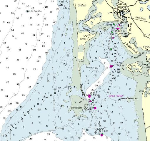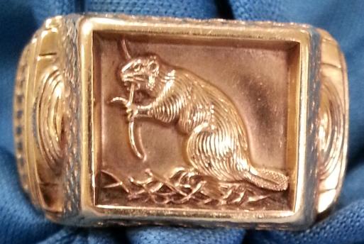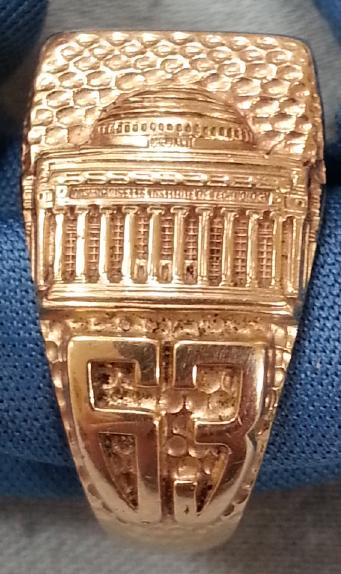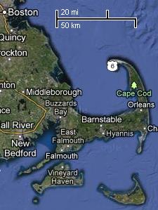
I was recruited to serve as a crew member by my friend and MIT classmate Martin Schrage. He himself was navigator for the voyage, on a boat named "No Sé", owned by a friend of his, Duane Marshall. The race was to start in the evening in Boston harbor. Sometime in the middle of the night, the boats needed to round an unlighted, silent buoy off the coast of Wellfleet. They were then to return to Boston for the finish the following day. After an uneventful start, Martin retired below deck to sleep a bit. This was because he hadn't gotten much sleep the night before, which for Martin was not an infrequent occurrence. I handled the sails, and got to know Duane as we sailed out of the harbor, and south into the Bay. Night fell (thud), and with no moon, it got pitch black. We turned on our battery-powered running lights. As we approached the middle of the Bay, our fearless navigator emerged through the hatch from below deck, and uttered the confidence-inspiring words, "Where the fuck are we?". We knew approximately where we were, of course, but that wasn't the problem. The problem was to find the buoy we had to circle. The rules of the race specifically required us to actually see it; to be close enough to read the number written on its side. Now the buoy's number was no secret. We could read it right off our chart. But each captain was honor-bound to actually see the buoy as it was rounded. We were specifically not allowed to make a large circle, and assume the buoy was inside. We needed to have visual contact to verify that we had truly gone around it. In any sailboat race, each captain depends on the honesty of all the others. After all, if you really wanted to cheat, it would be possible to sail off to one side of the bay and fire up an outboard motor to increase your speed. I think that now I need to say something about the navigational tools available at the time. These days, one could have a GPS (Global Positioning System) receiver, and hence be always aware of one's exact position, accurate to a few meters. But that system was not even dreamed of in the 1960s. There was a radio navigation system called LORAN (LOng RAnge Navigation), but operating at a lower frequency than modern systems, it was not extremely accurate, especially near the shore. In any event, our boat was not equipped with a LORAN receiver. So we were sailing by what is called "dead reckoning", reading our direction from a magnetic compass, and estimating our velocity using a device called an impeller log, towed alongside the boat on a short piece of cable. This had a propeller which spun in the passing water, reporting the speed of the boat to a display at the other end of the cable. We didn't leave the log in the water after making our measurements, as the propeller created a small amount of drag, so we only used it as needed. Racing sailboats need all the speed they can get. We weren't helped by the fact that for some reason, the compass was behaving erratically. What the boat did have was a sonar depth finder, a device which could report the distance from our keel to the ocean floor. It could also show schools of fish, although that capability was of no interest during the race. Prior to the race, Martin had been intrigued by the problem of locating the buoy in the middle of the night, and he hit upon the idea of making use of the depth finder. So he did his homework (yes, Martin actually occasionally did homework). He obtained a nautical chart of the bay, and prepared a series of bottom profiles that might be seen in various positions and at various headings, with depth samples taken a defined distance apart. A typical chart from the NOAA (National Oceanic and Atmospheric Administration) Office of Coast Survey can be seen below, although I think that Martin used a more detailed chart:  Martin's primary interest would be determining our boat's east-west position. Our north-south position could be determined by sighting lights on the shore, identified on the charts. The bottom profiles in the area were quite distinctive, I think because one of the purposes of the buoy was marking the edge of the hazardous Billingsgate Shoal. Thus, as we approached the approximate position of the buoy, we periodically tossed the impeller log overboard to measure our speed through the water. We corrected that speed by adding an estimate of the tidal currents at our approximate location at that point in the tide cycle, giving us our speed over the ocean floor. From this, we could calculate an elapsed time between depth readings that would give us a distance between readings to match Martin's pre-drawn bottom profiles. We read depth readings from the depth sounder spaced apart by those intervals, and called them out to Martin below deck. He drew it as a bottom profile, and matched it to his previously prepared samples to figure out where we were. Martin was below deck so that he could work with his charts at a lighted table. The hatch that led below was covered by a heavy, dark blanket. This was to keep us, above deck, from being blinded by the light in which Martin worked. We needed to keep our eyes dark-adapted, so that we could watch out for any nearby ships, and so that we could clearly see lights on the shore. Martin needed to be in the light, and we needed be in the dark. And so Martin worked below, calling out course changes to correct our East-West position. As we approached the right place, Martin called our attention to certain lights on the nearby shore. To determine when we had reached the correct north-south position, he told us to let him know when two particular lights on the shore lined up. When we told him they were in alignment, he said, "The buoy ought to be two points off the port bow". "Two points" is 22.5 degrees, if you want to be precise, but of course Martin's specified angle was only intended to be approximate. Captain Duane turned on a spotlight, pointed it straight ahead, and swung it towards the left. After a shallow angle had been traversed, there was a flash of light from a white reflective stripe wrapped around a black cylindrical buoy. Below the stripe, the expected numbers, rendered in white reflective paint. We quickly turned off the spotlight, lest it betray our position to any of our competitors who might be nearby. We then made a U-turn around the buoy, and headed back towards Boston. We took turns sleeping for the rest of the night. Duane gave me a quick course in sailing in the dark. With the wind from the northwest, we were tacking upwind, alternating between long starboard and port tacks. In this configuration, the sail is "close-hauled" (pulled in tight), and in order to achieve maximum upwind speed, the proper heading of the boat must be maintained at a fixed angle relative to the wind. In all the sailing I had done before, I had determined my heading relative to the wind by watching the sail. Turn too much into the wind, and the sail begins to "luff". That is, it loses its smooth shape up by the mast, as some air begins to hit it on the back side. Turn too far away from the wind, and the sail gets excessively tight. In either case, the boat loses upwind speed. Duane taught me, on the spot, how to sail by sound, since in the dark, I couldn't see the sail at all. Turn too close to the wind, and the sail beginning to luff at the leading edge makes a subtle sound (in fact, that front edge of a triangular sail is called "the luff"). Too far off the wind, and the tightening of the trailing edge ("the leach") reduces the fluttering sound that normally comes from there. We had no desire to shine the spotlight on the sail, possibly giving away our position to other boats (although this only mattered while we were still in vicinity of the buoy). As we headed north, we passed other sailboats, undoubtedly our competitors (who else sails in the middle of the night?), sweeping back and forth attempting to locate the buoy. We later learned that some of them had spent an hour or more looking for it. Martin's navigational technique had paid off. After a stunning sunrise, the remainder of the trip back into Boston Harbor took place on a beautiful sunny day. After crossing the finish line, we learned we had come in second. Meeting the first place winner later on shore, I noticed that like Martin and me, he also wore an MIT ring. Here are a couple of photos of my ring:   MIT students irreverently refer to this ring as a "brass rat", but it's really a "gold beaver" (the ring is solid 10 carat gold). The dam-building North American beaver (Castor canadensis) is considered to be the engineer of the animal world, which is why its image is used on the top of the ring. MIT is, after all, a "Technical Institute", most renowned for its courses in engineering. The side of the ring shows MIT's Maclauren Building ("Building 10") as seen from Killian Court - see my blog entry MIT people for an actual photograph of it. The "63" beneath that image is my undergraduate graduation year, 1963 (which means that I have a fiftieth reunion coming up in June). In recent years, the rings have varied a bit in their details, but they all are similar in design, and all have a beaver on the top. At 18 grams (0.64 oz), this is a pretty heavy ring, and I don't wear it every day. Many MIT graduates do, so after fifty years, their rings are very worn. But mine looks almost like it did the day it was purchased - I only wear it to meetings at MIT, technical conferences, and other such events where it seems appropriate. A lighter version of the ring is also available, and tends to be favored by female graduates, who are increasing in number. Only 21 women entered in my class of about 900, but these days, about 45 percent of the entering freshmen are women.
  |
