When I was born in 1942, cameras were widely available to the general public, but most of the pictures of me as a child (like the one on the left) were black and white. Color film gradually became available, but the cost of film and developing was quite high. Amateur photographers carefully composed their shots, and tried not to waste them. You didn't see your photos until you got to the end of the roll of film in the camera, mailed it to a lab to be developed, and waited a week or two for the prints to be returned. The first commercially available camera to produce instantly viewable prints (well, it actually took about a minute) was the Polaroid Land Camera, which was first sold in November, 1948. My grandfather Abe, who always loved gadgets, bought one, although I'm not sure in what year. I do remember him demonstrating it to us, and in November, 1948 I would have been almost seven. It produced small sepia-colored prints (a Polaroid film that rendered a true black appeared later). But Polaroid prints were even more expensive than conventional ones. Abe, by the way, later bought a 3D camera and viewer, and eventually, even a 3D projector. As a result of the digital photography revolution, we can now be said to live in a photographed world. People can now take as many pictures as they want, as they are essentially free until they're printed. They can be viewed on the camera itself, or a bit later on a computer screen, and the best images can be selected for printing. Or they are never printed, but forever viewed on computer screens. Furthermore, the addition of cameras to almost all mobile phones means that there are now cameras everywhere. No longer does an explicit decision to carry a camera have to be made before leaving the house. Finally, the availability of extremely low cost digital cameras, and low-cost disk storage, means that surveillance systems have proliferated. If you are anywhere on the streets of a major city, you have a good chance of being within range of some surveillance camera.
And that's what ultimately led to identification of the suspects. After all, the Boston Marathon is a heavily photographed event, so hundreds of people near the bomb blast had cameras ready. Once even low-resolution images had been made public, the FBI was deluged with better images of the suspects, making their recognition inevitable. I might add another feature of digital images that contributed to the speed of law-enforcement's response: photographs are now just digital files, and like any other digital file, they can be transferred electronically, most typically attached to an e-mail message. Someone finding an image of one of the suspects on his camera was able to send it to the authorities in a matter of seconds. Try to picture the FBI appealing for photos back in the days of film cameras. Film in all the cameras of amateurs would have to have been developed, taking several days, and then prints of interest would have had to have been carried or mailed to the authorities. Finally, we're now all monitored from above. On the Friday after the bombing, as the FBI closed in on the suspects, "suspect 2" (the man in the white cap) was located hiding in a boat being stored in the back yard of a house in Watertown, Massachusetts.
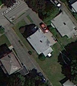
You can see the boat in question, on top of its trailer and covered in plastic, at the end of the driveway (April is still a bit too early to put a boat in the water in the Boston area). Although the address was not immediately announced, I could see the street name on a sign, from a vantage point occupied by reporters being held a short distance away. And the name was "Franklin Street". So naturally, I called up Google Maps on my cell phone, and started scrolling the satellite view across the screen, looking for a house that might match the view of the house being shown on TV. Franklin Street is not very long, so it didn't take much time to come up with the image below:
The shadow of the house makes it difficult to see the small entryway that sticks out towards the street, but a corner of it can be clearly seen. The boat is missing, presumably because it might have been left in the water somewhere during the summer. But the trailer is there, although I confess that on the small screen of my smart phone, I didn't spot it immediately in the shadow of the tree. Here are the main points that convinced me that I had the right house: 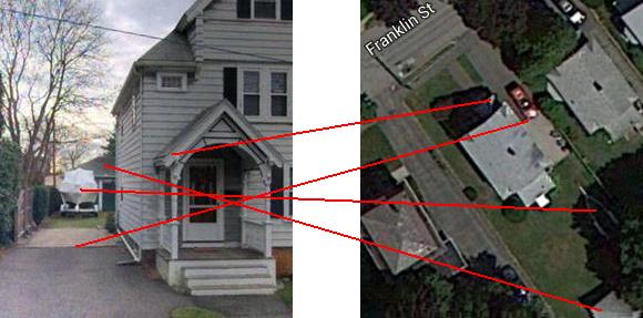 The lines point out: - The entryway
You can also make out the tree over the building in back, and the fence alongside the driveway and lawn. Obviously the red car shown in the satellite view is not present in the street view. These images were taken at entirely different times. The pictures just above are screen shots from my Samsung Galaxy S III smart phone, which I was using to access the internet from my couch while watching the television set in our den (I don't have a laptop computer). Thus, our photographed world allowed me to follow along with developing events in real time. By the way, although people refer to the images on Google Maps as "satellite views", most of Google's high-resolution imagery of densely populated areas comes from aerial photography, from aircraft flying at 800–1500 feet. Note 1 You can see the difference between the true satellite imagery and the aerial photographs as you zoom in. Here are two different images of the house in question in Watertown, marked with the letter "A". Although these images are both from the same Google Maps site, the photo on the right is zoomed in one level of magnification: 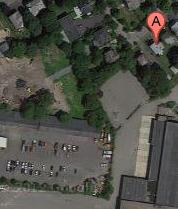 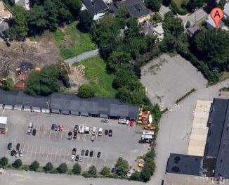 It's clear that the two images were taken at different times, as there are different cars in the parking lot. The image on the right is also taken at a more oblique angle, so it would not have been useful to me to identify the house (the tree blocks almost all the points of interest). But the image on the right also has much greater clarity and detail. I think the left-hand image is from a satellite, and the one on the right is from an airplane. My cousin Steve Krakauer sent me the image below of a location in New Jersey: 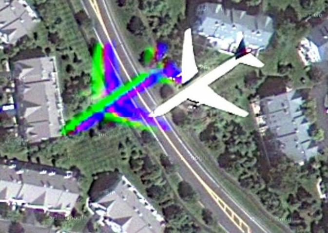 An airplane, which Steve identifies as a 737, just happened to be flying below when the picture was taken. I don't understand the brightly colored image to the plane's left, but I suspect it's a camera artifact due to the very bright solar reflection from the plane's shiny surface. If you want to see this image on the Google site, where you can zoom in and out, go to http://goo.gl/maps/NgECB.
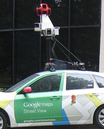
But satellite views reveal little compared with Google "Street View", captured by panoramic cameras like the one seen on the left. These have caught couples having sex, flashers, dead bodies by the side of the road, a woman giving birth on the sidewalk, and even, allegedly, a philandering husband. Note 2 If you want to see some of these images, try doing a search (hey, you can use the Google search engine to do so). Google appears to have a policy of removing offensive images when users flag them. But it's clear that in the ordinary course of operations, images are automatically moved from the cameras to the web site without necessarily ever being viewed by a real human being. We truly live in a photographed world. Scott McNealy, co-founder of Sun Microsystems, allegedly said, "You have zero privacy anyway. Get over it."
  Note 1: See http://en.wikipedia.org/wiki/Google_Maps [return to text] Note 2:
You can see this image in various sizes here. This work has been released into the public domain by its author, Kowloonese at the Wikipedia project. [return to text]
 |

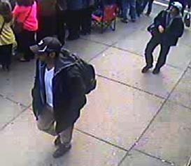
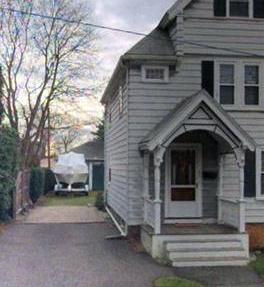 As the police converged on the boat, an image of the house in question was flashed on our television screens. And where did that picture come from? Some "street view" web site (I don't think it was Google Street View in this case).
