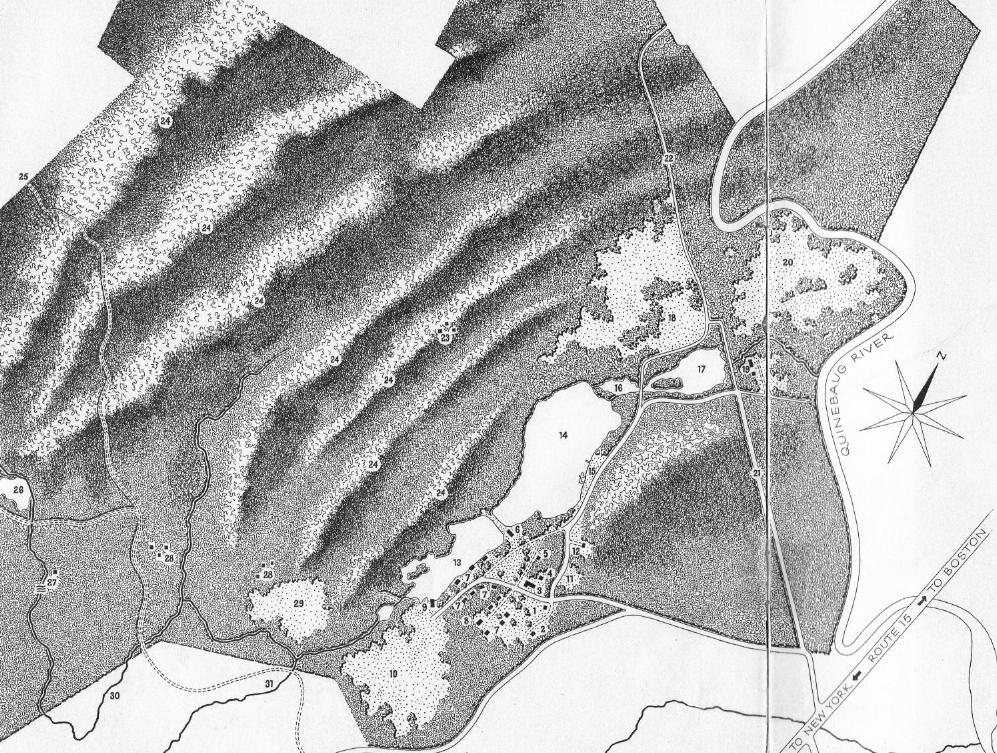
The following map of the camp land was made by Nils Frederiksen, for a camp brochure. See below the map for a key to the numbers.
| 1. Camp office
2. Campers' post office 3. Main house / dining room 4. Infirmary 5. Staff house / Canteen 6. Arts & crafts shop 7. Campers' cabins 8. Recreation hall |
9. Nature Laboratory
10. Athletic field 11. Parking 12. Lumber yard 13. Mallard pond 14. Pickerel pond 15. Swimming beach 16. Trout pond |
17. Squantum pond
18. Squantum field 19. Primitive camp 20. Canoe landing field 21. To Old Sturbridge Village 22. To Old Sturbridge Village 23. Old Pogus Village 24. Seven ridges |
25. To Lead Mine Mountain
26. Grist Mill pond 27. Grist Mill Falls 28. Colonial mill village 29. Settlers' field 30. Cannon brook 31. Hamant brook |
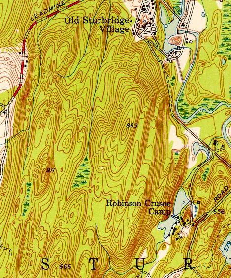
Although the existance of "seven ridges" between the camp and Leadmine Road was an article of faith among the campers, the depiction of the ridges in the above map seems to be rather an approximation. Below, a topographic map of the area from 1952. The "ridges" don't really seem to be so well defined: